- Home
- Accomodation
Accomodation in France
THEY TRUST US


- Activities
- Tourism
Tourism in France
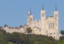 Tourism Lyon
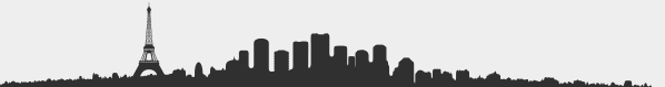
 Tourism Paris
 Tourism Marseille
+
Tourism Marseille
+
Cultural places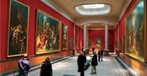 French Museum
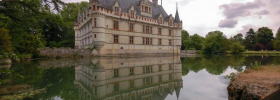
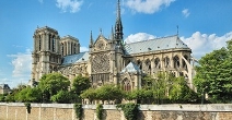 French monument
Vacation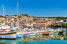 Seaside resort
 Winter sports resort
 Spa
Spa
- Tours
- Events
- Guides
- Car rental
Rent a car for your trip


- Blog


 Home
Home- > Tours
- > Provence-Alpes-Côte-d'Azur
- > Bouches-du-Rhône
- > Fontvieille
- > Fontvieille
Fontvieille
| Topic | Sciences and discovery |
| Departure | FONTVIEILLE (13) |
| Details | Fontvieille is a french town, located in the department of Bouches-du-Rhône and the area Provence-Alpes-Côte d'Azur. |
Visit Fontvieille

Fontvieille is situated in the heart of the "Provence des Alpilles", not far from the historic arena at Arles, the citadel of the Baux de Provence, the museums of Saint-Rémy and the Avignon Festival which is less than 30km away !
After having left Arles, you will follow a pretty road (the D17 in the direction of Les Baux and Maussane) which crosses the superb countryside of the Alpilles with its vast fields of olive trees, shrubs and lush green fields, with the majestic Montmajour abbey in the distance.
Arriving in Fontvieille, you will discover a picturesque village with its ancient houses built from stone extracted from the famous quarries founded in the 15th century.
The arenas at Arles and Nîmes, the 14th century chateau at Tarascon, and most recently the Palais Longchamps and the Bourse at Marseilles have all been built from the same stone.
Fontvieille is the village where Alphonse Daudet wrote his famous "Lettres de Mon Moulin". To visit the "Moulin de Daudet" and its small museum, climb the small hill until you reach the summit where the wind-mill overlooks the valley.
From the hill (easy to climb), you will have a superb view of the Alpilles and the "Château de Montauban" where Daudet lived from time-to-time.It was here, surrounded by this "scenery of stone" (or "caillasse" as they say here), on this hill-top covered in olives, pine-trees and oaks that Daudet found the inspiration for his stories.
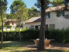
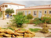
Accommodation nearby
Guided tours in Fontvieille

The quality, the various themes of the conducted tours distributed by the tourist office of Fontvieille are particularly intended for the school public. To know the history of Alphonse Daudet, that of the old village, of the antique past of Fontvieille and indeed the other discoveries, don't hesitate to get in touch with the guide service of the tourist office...
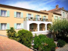
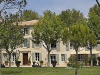
Accommodation nearby
Discover The roman aqueducts and flour trade mill

Visit, in a field of olive trees, an exceptional monument of the roman period. Technical and historical explanations will make you discover this unique site in Europe. - Set price: 2 € per adult - Duration: 1 hour 30.
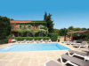
Accommodation nearby
Les Baux of Provence and its Castle

Only on reservation. Discover one of the most legendary sight in Provence. Also classified nowadays as one of the most beautiful village of France. This classification is at the moment unique in the Bouches-du-Rhône.
Visit of the village only ; Set price 92 €. Duration: 1 hour 30
Visit of the village and the castle: - Set price 128 € - Duration 2 hours 30
Visit of the castle only- set price 92 € - Duration 1 hour 30
To see: Castel of Baux.
Accommodation nearby
Circuit "Les Crottes d'Aubert"

Circuit set up by the Club of physical activities of Fontvieille by the Windmill of Daudet, the Roman vestiges (aqueducts and milling), drailles and the castle of Montauban. Distance: 9,5 km. duration: 4 hours - Circuit of average difficulty. Departure: Allée des pins (Car park). Follow the Blue marking. This pedestrian circuit can be forbidden in summer according to meteorological conditions imposed by the prefectoral devices to fight against the fires
Warning: closing-time of Montauban’s park at 5:30 pm (the opening is prolonged according to season).
1/ Take the road of Daudet’s windmill, behind the mill go down to rejoin the Yellow Marking and follow it on the right in the direction of the South East, passage of the barrier n°14 (with picnic area, benches) then passage at the barrier n°13, at the signpost, follow the direction to the right "Les Baux of Provence", passage of the barrier n° 12 (car park in border of the road D33) Pursue the way in border of the road, again a car park at the barrier n°8, follow the Blue marking (and Yellow also) on the left, then follow to the right, passage of the barrier n°6.
2/ We are always on the blue plan, passage of the barrier n°5, passage on the canal of watering in the road R8, Follow the Blue Marking to the right by the road up to the Roman aqueduct and the milling, return by the same road towards the barrier n°5. 3/When you arrive at the crossing road that indicates the different trails and roads, take to the left the road DFCI N A 180, passage of the canal, the barrier n°5, set to the right, Blue Marking which you will follow up to the end of the route, This road all in curve leads to the barrier n°3 and to the car park, to the left in the direction of the North you will take the forest road n°2, you will arrive to the buried tank 138 " the forest ".4/by pursuing this road - in (East-north-east) direction(management) E-N.E azimuth 50 ° approximately from the road, then after 150 metres, in the direction of the North. You will arrive in front of a high rock and set to the left towards the limit of the quarries of Fontvieille with a fence on the right of the road. The narrow road "Les bâches" joins the municipal fitness trail on the right towards the park of the castle of Montauban in passing in front of the skate park. Through the village you will rejoin the car park of the “Allée des Pins”.
3/ When you arrive at the crossing road that indicates the different trails and roads, take to the left the road DFCI N A 180, passage of the canal, the barrier n°5, set to the right, Blue Marking which you will follow up to the end of the route, This road all in curve leads to the barrier n°3 and to the car park, to the left in the direction of the North you will take the forest road n°2, you will arrive to the buried tank 138 " the forest ".
4/ by pursuing this road - in (East-north-east) direction(management) E-N.E azimuth 50 ° approximately from the road, then after 150 metres, in the direction of the North. You will arrive in front of a high rock and set to the left towards the limit of the quarries of Fontvieille with a fence on the right of the road. The narrow road "Les bâches" joins the municipal fitness trail on the right towards the park of the castle of Montauban in passing in front of the skate park. Through the village you will rejoin the car park of the “Allée des Pins”.
Accommodation nearby
Circuit "Les Vallons des Raymonds"

Circuit towards the “valleys of Raymond” up to the Roman vestiges of the aqueducts on the road of Arles. Circuit set up by the Club of physical activities of Fontvieille. This path of the GR 653d is also the pilgrimage of Santiago of Compostela towards Arles. The departure of this path is the point of convergence towards Arles of the Domitienne way (Montgenèvre, Cavaillon, Saint Rémy de Provence, Saint Gabriel) and of the ancient Aurelienne way (Menton, Aix en Provence, Salon de Provence, Maussanne, Fontvieille and Arles).
This road is perpetuated by the FFRP (French Federation of hike) and the affiliated clubs of which CAPF Fontvieille belongs. CIRCUIT: easy. Route (go and return) - 6 km400 Duration: 1:30 h. - Red and white marking. *( ffrp ). Hiking shoes - water - binoculars. This pedestrian circuit can be forbidden in summer according to meteorological conditions imposed by prefectorial devices to fight against the fires. Warning: closing of Montauban’s park at 5:30 pm(puis ouverture prolongée selon saison).
Follow the marking in the direction of the South towards the Daudet’s windmill, after the petanque’s platform (traditional game of boulles), in front of the gate of the municipal kindergarten, take to the right and join the low lane, you will go back up after 70 metres (caution on the road) go at the opposite to the barrier, then after on the right, walk past the water tower, then the ruins of the windmill Sourdon. By continuing towards the right we arrive at the end of the street of the stadium. there, you go down this street and you take on your left you will see then the street of the Dr Julien or the path of the Gravelettes, farther after N ° 26 from this street you take a road to the right, then you enter the valleys of Raymond and its roads through the plots of land of olive trees, pines, you arrive to a point of view. In front of us a very wide horizon offers itself with the former(ancient) swamps of Figuerolle - of the big Clar and the pond of the Gravel pit (every defenders with the others of the Abbey of Montmajour), far off Arles, Montmajour, the mountain of Ropes (alt. 64m) and the wet meadows. We are going to arrive in a valley and discover the ruins of the Roman aqueduct bridge ( the bridge Simian).
It will be the end of this circuit and you shall return towards Fontvieille by the same path. By pursuing westward your steps will lead you to the Abbey of Montmajour and Arles. The bridge Simian: this aqueduct bridge is one of architectural work that the Gallo-Romans of Arles had built to bring the water of the Alpilles to their city. It is part of the northern aqueduct of the Alpilles fed among others by springs around Eygalières and, according to very nearby contour lines, followed the north side of Alpilles to “Saint Gabriel”, it returned towards Fontvieille up to the castle of Estoublon to restart towards Arles. It turned to the “Calade” to rejoin the “Valleys of Raymond” and reach the “Valley of the Arcs” where it joined its waters in a convergence pond to those of the south side of the Alpilles where a second shorter aqueduct, forwarded up to there through the “defends of Sousteyran”.
Underground passage on the major part of its course, it stays so at the same height. The duct had to pass on bridges in order to cross the valleys. It is so for this valley as for several others situated more in the East in the “Valleys of Raymond”.
This aqueduct bridge of 48 m long and of 6m of high was built during the 1st century after J.C. as the city of Arles was building its first monuments. Three arcs situated mostly on the Westside give evidence of its dating by the type of construction in big device.
A part of the duct coated with its mortar of tuff and brick is still very visible in its western extremity. Between the first and the fourth century the bridge was doubtless the object of several repairs in small device as it was the case for both aqueducts bridges of the “Valley of Arcs”. By following the water’s course, the first arc (on the West) and the last arc (in the East) were so blocked during the antiquity to strengthen the work by reducing strictly speaking the bridge which became partially a kind of retaining wall less sensitive to the ground movements.
Beyond the Roman period the bridge was not totally abandoned, show of it a sundial engrave) on the south face and the rests of farmer's hut. The central arcs were doubtless blocked by low walls of dry stones similar to those of the “Restanques” (Platform created by the payment of the upstream of the slope and the embanking of the approval) of the valley during the XVIIIth century.
During the excavations was discovered a skeleton interred long after the antique period the presence of which near this bridge remains very mysterious! The narrow-minded arcs of the bridge retained alluviums in time and thus allowed to study the erosion of the valley to make an archaeological study of the evolution of the landscape and to list the modes of culture of the implemented ground.
The researchers thanks to whom this bridge and its environment are henceforth better known to us are: B. Hitchner and P. Bellamy, J.L. Swung and Mr Jorda. Bibliographical source: archaeological Map of the Gaul 13/2 Alpilles and Montagnette.
Accommodation nearby
Circuit bicycle touring: Fontvieille - Paradou - Maussane

Circuit recommended by the Cyclo club fontvieillois. At the beginning of Fontvieille. Departure centers village of the crossroads of the post office. Direction Raphèle D33 to pass in front of the Mill of Alphonse Daudet (visit). 2 kilometers on the left direction aqueducts and the Roman flour-milling known as of Barbegal (visit) Paradou D78E 6 kilometers. In Paradou D17 100 meters direction Beams of Provence D78D 2 kilometers. With the crossroads with the D78F return on Fontvieille 6 kilometers. For the most courageous Beams of Provence altitude 175 meters. To go return Beams of Provence plus 6 kilometers. Then return towards Fontvieille. Total: 16 kilometers or 22 kilometers.
Accommodation nearby
Latest news on : Fontvieille
Tourism near
 Visit the city of Fontvieille
 - 7 Museum
- 15 Monuments
Tours
 Tour to explore Marseille
 In the footsteps of Marcel Pagnol
 Discovering Arles city
 Tour de Provence (cycling tour)
Partners