- Home
- Accomodation
Accomodation in France
THEY TRUST US


- Activities
- Tourism
Tourism in France
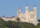 Tourism Lyon
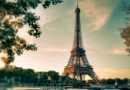 Tourism Paris
 Tourism Marseille
+
Tourism Marseille
+
Cultural places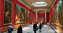 French Museum
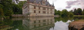
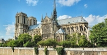 French monument
Vacation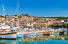 Seaside resort
 Winter sports resort
 Spa
Spa
- Tours
- Events
- Guides
- Car rental
Rent a car for your trip


- Blog


 Home
Home- > Tours
- > Poitou-Charentes
- > Charente-Maritime
- > Saint-sornin
- > Hiking in st sornin
Hiking in st sornin
| Topic | Walks |
| Departure | SAINT-SORNIN (17) |
| Details | Pedestrian walk about 3:30 |
Hike 3:30 to 5am

Footpath
Camping .... In the village of Saint Sornin
About 3:30 to 5am walk
Once crossed the barriers of the camp, take immediate right at the intersection of two paths take the right one
Then follow the path of sand
Here you are in a Natura 2000 area
Natura 2000 is a network of the European Union. Natura 2000 sites listed are valuable patrimonialepar an exceptional flora and fauna they contain.
This area is designated Natura 2000 because it has a floristic interest. The site also has valuable fauna by the presence of endangered animals such as otter and pond turtle (little turtle), the beetle Rosalia alpina, insect protection, the law prohibits the capture, the dragonfly Calopteryx haemorrhoidalis a rare species in Europe or snail Vertigo moulinsiana (snail).
On your right you will see careers. Their name is explained by the working conditions of workers they are called careers of hell.
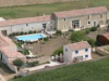
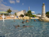
Ponds to our campsite Mina
Cadeuil quarries have, since 1976, left the room for three fishing ponds. Then was added the activity of camping. Swimming is prohibited in the ponds, because of their depth 18 m and source currents.
At the intersection, take the left path
At the next intersection, go straight
Arrived roadside, turn right
Saint Sornin
Its inhabitants are called the Holy Sorninois and St. Sorninoises. There are currently about 307 inhabitants. St. Sornin is a corruption of the name of Saint-Saturnin, who was the first bishop of Toulouse, martyred in AD 250. The village long will the name of Saint-Saturnin Marennes before becoming St. Sornin about 1902
Until the end of the Gallo-Roman antiquity, the village of Saint Sornin was fully washed by the ocean, which formed the Gulf of Santon.
In the seventeenth century, it disappeared, giving way to vast expanses
swamp, as can be seen from the medieval site of Brew.
Arrived in St. Sornin, turn left and head to the foot of the church.
Go around the church on the right
On your right, near the school, a panel will give you the first instructions to discover the village of Saint Sornin ...
For our circuit you must follow the colored arrows light blue / gray ...
The circuit with the light blue arrows / gray you back up to the church square.
Then turn left, then take the driveway of the school on your right
At the end of this alley, turn right
Now is the time to choose:
- Or you can turn right back at the campsite SHORTEST PATH
- Either left, Discovery Tower Brew THE LONGEST JOURNEY
If you turn left at the first intersection take the left path, you cross the marshes of Brouage
If you turn right at the next intersection turn right
Brew reached, take the first road to the left
Along the picnic table and take the path up the tower Brew.
You have reached the bottom of this ancient castle ... Finally what is left
Tower Brew
A tower built on a hill 27 meters high is all that remains of a mighty castle which dates back to the eleventh century. At that time, the marshes had not yet formed, and the ocean beating against the walls of this important building. He served as a lookout (monitoring station) and bitter (position cue) for vessels arriving in port, Brew is a seaport, which was enriched in the salt trade.
The castle was organized with an interior courtyard, a chapel and a dungeon that measured nearly 30 meters high, it measures over 25 meters today, the whole being enclosed by a series of ramparts, which there are some remains.
Beside the tower there is the Brew house which is the museum of the dungeon,
It offers exhibitions and field trips. Find out!
To return to the camp exit in front of the house of Brew
Take the road opposite. After a few steps to your right the ruins of the Church Brew.
Arrived at an intersection, turn left.
And right after, take the path right (sign "fishing ponds", the field of Mauvinière)
A few steps further, you will find the path to go. At the intersection continue across
You come back here at the campsite pools mina
Accommodation nearby
Latest news on : Hiking in St Sornin
Tourism near
 Visit the city of Saint-sornin
 - 4 Museum
- 4 Monuments
Tours
 A week-end to discover La Rochelle
 Broue tower
 The gourmet walk
Partners