- Home
- Accomodation
Accomodation in France
THEY TRUST US


- Activities
- Tourism
Tourism in France
 Tourism Lyon
 Tourism Paris
 Tourism Marseille
+
Tourism Marseille
+
Cultural places French Museum
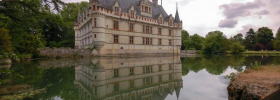
 French monument
Vacation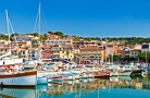 Seaside resort
 Winter sports resort
 Spa
Spa
- Tours
- Events
- Guides
- Car rental
Rent a car for your trip


- Blog


 Home
Home- > Tours
- > Poitou-Charentes
- > Vienne
- > Angles-sur-l'anglin
- > Discovery trail angles-sur-l'anglin and surroundings
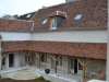
Discovery trail angles-sur-l'anglin and surroundings
| Topic | Walks |
| Departure | ANGLES-SUR-L'ANGLIN (86) |
| Details | Angles-Sur-L'Anglin is ranked "one of the most beautiful villages of France" and has "3 flowers" in the selection of villages in bloom. moreover, its medieval streets are still living testimony of its rich historical past. |
"Ville haute"

Accommodation nearby
"Ville basse"

Accommodation nearby
Discovery Paths of Anglin

Departure: On the spot Length: 8 km Time: 2:30 to average speed Road markings: yellow Description: Down under the bridge, walk past the mill and take the "path of the dungeon (along the cliffs). 800 meters further on, leaving the left path which leads to the hamlet of Boisdichon. Continue towards the Moulin du Pre and walk past the trough of Boisdichon. A 1 km, left on the left the rugged road of "Binoquerie. Continue to the old miller's house where we saw the mill. Continue to walk in the path of "Rezan" and engage in the shady arch that leads to an old barn. Opposite, on the right, an oak needed, majestic. Leave on the left, the other farm buildings Rezan and continue for 300m to reach the Valley of the Devil. Slight then left to exit the valley Anglin and ascend the stream bed (dry) that meanders between bushes and rocks. 300 m away, leaving the Valley of the Devil by borrowing on the left the steep path of "La Bauge to the Lady", then cross the plateau to plan Certeau where we discover on the right a beautiful loft. Go down to the hamlet of Boisdichon to the cave. Continue the road and then turn left just before a nice boxwood carved a unique way. Then follow the path of "Coteaux" to discover 500 m along a magnificent view over the valley of the Anglin. Go along the campground and continue the asphalt road. Turn left down the road to reach the place.
Accommodation nearby
Discover sunken roads around corners

Departure: On the spot Length: 7 km Duration: 2 h at average pace Road markings: yellow Description: Mount in the Chapelle St Pierre, walk on the left onto the campground road. Turn left and descend to the road to the castle Certeau. Go then on the right side to the gate of the castle. Commit then left onto the Chemin Vert (north-facing mossy green throughout the year, its freshness is especially popular in summer). At 300 meters from the entrance, we noticed on the left, the presence of a "box" collapsed. Continue the path, there are two options for reaching the road Fournioux: - Turn left towards "Les Combes", or - Continue straight up the road. Take then the highway to the "Brelignerie" on the left. Follow this road to reach the junction with the Wood-Guernaut. Continue on the left to D2. Get 50 m towards the corner and turn right at the cross to take the path of "The Mitaudière. Leave this road 25 meters turn left for one who catches the Road Neons sur Creuse. At junction, take the opposite road to the water tower (left to cross the left of "Small Breux). Skip to walk to it and continue towards the road Vicq (D5). 50 m away, a beautiful lodge bordering a field. A crow's feet, merge onto the left path. The crossing and turn right on "Path of American." You will notice on the right site Remerle his ford and mill. At the bottom of the trail, turn left on road parallel to river. On the other side, stand the rocks Remerle and farther south to the Rock (curiosity to discover along the circuit 2). Then leave the road and take the right path that joined the area picnic. Shortly before that, back in "burrow" leading to the horn and Hutch after a halt under the chestnut trees, joining the site.
Accommodation nearby
Discovery village of Luss on the left bank of the Anglin

Departure: On the spot Length: 8 km Time: 2:30 to average speed Road markings: yellow Description: Down in the lower town and turn right after the bridge towards the cemetery. Commit to the left before the cemetery gates to climb the foot Moncot. Then take a slight right and follow the path. Turn left just before noon at the Rock in order to lead a dozen yards farther down the road paved. Take then right towards the farm Remerle. At the end of the road, engaging in the opposite path down, clearing the fence by the small passage constructed for this purpose. In order not to disturb the many flocks of sheep present in this area, it is essential that everyone respects the fences in place and avoid panic beasts. Turn left at the bottom of the road and continue along the Anglin. High cliffs rise on the other side. A little later, we see the hamlet of Sweet then joined the two water spout, where Anglin joins the Gartempe. It then enters the territory of the commune of St Pierre de Maille. On the other side of the Gartempe, we see the castle Bédoui, then the hamlet of Tuileries. Continue to the ordeal and then turn left onto Lussis, purpose of the walk. To regain control of angles, turn left into the center of the hamlet. After the last houses of Luss, the road descends slightly to back then. It splits into two and offers two routes to Angles. The first (left) Débuché nearest farm Remerle. The second (right) along the valley of Vaux and leads further along the plateau Villevert. Whatever the route chosen, everyone will notice the striking contrasts of the vegetation. Both paths winding first through a grove of wild juniper, birch and heather and then discover a more humid forest, with oak trees. If one chooses the first route, emerging from the forest, veer left into a meadow to reach the path leading to the road (the entrance of the path lies on the right side of the meadow). If one opts for the latter, simply follow the trail to the road. Join Angles by road or take the route back circuit No. 2.
Accommodation nearby
The walk of "foot-branded"

Departure: On the spot Length: 8 km Time: 2:30 to average speed Road markings: yellow Description: Cross the bridge and follow the road of Saint Pierre de Maille. Take the 1st road on left, along the course of Anglin, leads to foot-Griff. At 300 m on the right, go up a little hill to discover the cellar of the Capiauron. To enter, boots and flashlight are recommended. Back on the road to Griffé Foot-and 300 m further turn right into the path of craggy Cauldron (a hole in the cliff-like shape of a large tank or a "cauldron") Follow this path until a fine stone cross erected in 1884. Turn to the cross and take the first path on the left. 70 meters left, we noticed the fountain in the pot, also called "Fountain of Blatier" because according to some, the level of its waters indicated the former corn merchants the importance of the coming harvest. 300 m away, the great dolmen of Liboureaux is the only region that is still standing, though his table be strongly considered. Continue the path for 200 meters. Away on the right, outside lighting, we can discover a 100aine yards from the path a little dolmen ruins, then 50 m to the south a line of stone posts and upright slabs. Then resume the path of 500 m around, then turn left down the path of Rivolet said that after several turns leads to the houses of Foot-Griff. At the bottom of Rivolet, you can either return to the Angles, or continue the walk on 2km500. To return to Angles: Turn left at the bottom of Rivolet and follow the road. It passes through the foot-grip and lets see a beautiful panorama out of the hamlet. The road leads to the following angles Anglin and his cool and shady bank. To continue the walk on 2km500: Turn right at the bottom of Rivolet to take the road of Vilaine. 50m further turn right again onto a dirt road (without markup) you will see a beautiful old oak known as "Oak Stand-Scratched" Up the coast, on the right, a thorny thicket contains a table of dolmen, on the ground. Back on the road continues towards Vilaine. 600 m further on, in turn, take the dirt road on the left through a wasteland of juniper and down to the River. Has 50aine yards on the left, you may discover a career sarcophagus and the statue of the Sphinx. The entrance to the quarry is prohibited, but through the safety grid, we can see traces of tearing sarcophagi. The statue is at the southeast corner, sort of a human head wearing a cap with 2 legs one of which ends in claws (meaning unknown) Back then Barnyard Scratched or by taking the opposite route, either along the riverside. (Caves and rubble of Roc Fade) Not recommended in wet weather, (private property). A Pied-Griffé follow the circuit back to normal angles.
Accommodation nearby
Walk the rock at noon

Departure: on the spot Length: 3 Km 500 Duration: 1:00 average Road markings: yellow Description: Cross the bridge, get off right then turn right into the path of the cemetery of Lesser Town. At 150 m, enter the cemetery to discover a Cross Hosannière XIIth century, sarcophagi, a tombstone-shaped menhir and the tomb of Samuel Perivier (1828-1902), first President of the Court of Appeal of Paris and former mayor of Angles. Leaving the cemetery, take the path along the river for 300 meters, turn left then right 25 meters. Then mount the burrow of "Wood Luneau. At the top of the burrow, the impressive rock at the Roc Midi stands in balance to nearly 40 m above the Anglin. The legend says that the girl "wise" that will run at noon on Friday will surely marry this year. Then proceed to 50 m below a magnificent view of one of the curves Anglin, the valley criss-crossed by numerous dry stone walls and the distance of the city of Angles. (Downstream, Remerle old mill and lock.) Back up to the Roc in south and get off the path in the opposite direction then turn right onto the trail climbs slightly. Turn left and continue until a crossing. Two routes are possible: - The first is to lower the terrier Moncot foot, along the Lower Town cemetery and take the direction of Pont and of the place; - The second reveals a magnificent panorama of the City of Angles and the old castle. To do this, turn right at the top of the burrow and follow for 400 m around the peak path. At the end of the road, turn left into the path "Rabat", descending to the "Old Street". In this street on the right, still the remains of an ancient tower that probably once marked the entrance to the Lower Town. Hence the bridge and back up on the spot.
Accommodation nearby
Latest news on : Discovery trail Angles-Sur-L'Anglin and surroundings
Tourism near
 Visit the city of Angles-sur-l'anglin
 - 3 Museum
- 1 Monuments
Tours
 The walk of Rezan
 Welcome to Tournon-Saint-Martin
Partners